


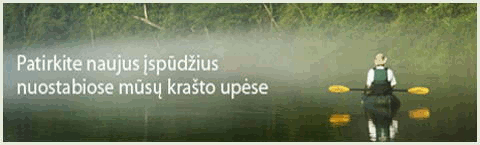
The river Tatula flows in Panevezys county, Birzai and Pasvalys districts, the river Musa right tributary.
Length of the river 66 km, the basin area 504 km ². The source at Cypenai village, 5 km southeast from Vabalininkas town. From the source the river a few km flows to southwest, turns to northwest, from Kirdoniai village flows to southwest again. Flows into the river Musa 45 km from its confluence with the river Nemunelis at Azuolpamuse village, 6 km northwest from Krincinas village. Average gradient 86 cm/km. The valley dominating width 0.3-0.5 km, floodplain width 0.2-0.4 km. At villages Juodeneliai, Kirdonys, Raubonys on the valley slopes many springs. The current calm. Average rated discharge upstream the brook Lieknelis 0.97 m³/s, at the mouth 2.62 m³/s. Discharge at Trecionys (5 km to mouth): max 81.0 m³/s, min 0.087 m³/s.
At higher water level. Spring, or after heavy rains.
Rapids, shalows, strainers.
WW 0/1 (2).
Distance from the mouth
17.4 Pasvalys - Birzai road bridge. right Pabirze. left Gerkiškiai. Average rated discharge approx. 1.8 m³/s. The river flows through meadows, in some places small forests. The current speed average. The river width 6-10 m. Can be a few strainers. Shalows, small rapids.
14.8 right Smardone.
14.3 left Ceniskiai.
11.3 Bridge. left Kirdonys. right Kirdoneliai. Average gradient to the mouth 161 cm/km.
11.0 left Upyte.
9.2 Bridge. right Daniunai. left Juodeisiai.
8.0 left Juodlepse. Average gradient to the mouth 170 cm/km. The current to the mouth fast, rare small rapids, can be a few strainers.
7.8 Bridge. left Juodzionys.
6.8 Small bridge. right Balciuniskis.
5.3 Small bridge. left Trecionys.
4.3 Bridge. right Dagilyne.
3.9 right the brook T-4.
1.7 Bridge. Raubonys.
1.1 Vilnius - Ryga highway bridge.
0.8 right the brook T-2. right Azuolyte.
0.2 left Uge. left hillfort Azuolpamuse.
0.0 The Tatula flows into the river Musa.
© 2014 J.D.Endriukaitis