


Neris or William (Belarusian Вiлiя) flows in Belarus and Lithuania, the Nemunas and the largest right tributary. Length 510 miles (235 km Lithuania), the catchment area 24,933 km2 (Lithuania 13 972 km2). The second largest river in Lithuania. Starts Minsk highlands in the northern part of the Šilancų, 15 km north-west of Begomolio. The Buivydžių crossed the Lithuanian border. The very upper reaches of the river only a few meters wide, the Vileikos plumpness of up to 30 m and more, at the mouth of USOS 60-80 m and Žeimena mouth about 75 m and 90 m in Vilnius to Jonavos about 100 m near the mouth to 240 m wide. In some places the river extends to 300-350 m (Vilnius to Panerių). Stony riverbed. From Žodiškių (Belarus) to the estuary is about 100 rifts. Most rifts - Karveliškių-Verkių, Vokes-segment length, Kaspariškių-Padaiga and Turženai-Karmėlavos sections. Many rifts have names. The largest - Aries, morose, and salt, and their length of 350-800 m, depth 0.8 to 1.3 m, flow rate from 1.5 to 1.9 m / s. Average river slope of 32 cm / km individual sections - from 20 to 76 cm / km. Flow rate ranges from 0.6 to 1.9 m / s. Flow rate at Vilnius max. 1680, vid. 116 minutes. summer, 28.0 min. in the winter of 20 m3 / s to Jonavos max. 2090, vid. 187 minutes. summer, 47.0 min. winter 34 m3 / s avg. estuary flow 189 m3 / s. Over the years Neris take you to the Neman 6 km3 of water. The spring run off 42% in the summer - 18% in autumn, 21% - in the winter - 19% of the total annual volume of water. Typically spring flooding begins in mid-March and lasts until mid-May. Flood, the water level at the mouth of Žeimena average rise of 4 m, 3 m in Vilnius, Jonavoje 3.5 m, 4 m in Kaunas. Floors during the flood - the mouth Žeimena average rises 8 m, 6 m in Vilnius, Jonavoje 7.5 m, 8 m in Kaunas. During the summer the water level to stabilize in mid-May. At least the water flows down the river in July-August. In summer, rain often floods during which the water level rises an average of 1.2 m, in some cases, up to 3.5 m. The highest measured summer flood discharge Vilnius 570 m3 / s, Jonavoje 954 m3 / s.
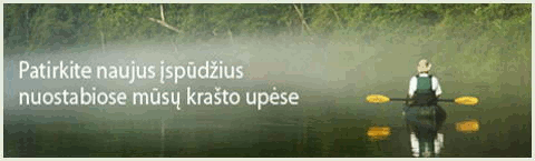
All the year round
Rift.
WW 0/1- (1 +)
234.7 dš.Baluoša. dš.Prienai. Neris flows Lithuanian-Belarusian border, lauždamasi through personal highlands of northern headland Riečan great Buivydžių loop. Loop dš.Bareišiūnų forest. A narrow and deep valley, its slopes are 35-50 m high, steep, banks to Vilnius forests. Current is relatively fast. Loop a number of small lakes,.
233.6 dš.Viršupio mound. Anieprikos shoal
232.0 dš.Moliai.
229.3 Šalnaitės shoal.
228.1 Island. Neris flows through the territory of Lithuania. dš.Šukeliškė. By Buivydžių kr.Girdžiūnų forest.
227.1 Island. dš.Kūniškė.
226.3 kr.Girdžiunka. kr.Buivydžiai.
226.0 kr.Ailupis. kr.Buivydžiai. By Stražnikų kr.Buivydžių forest. Avg. slope to Žeimena 24 cm / km.
223.6 dš.Perčina. dš.Perčinė. dš.šlaite outcrop. By Žeimena both shores of the St. John's forest.
221.7 dš.intakas of voxels lake. Island.
221.5 Mergos Wiehl shoal, river stone wolf. kr.Vilkinė.
221.3 kr.Manierka.
220.5 kr.Stražnikai.
220.0 Bridge.
219.7 kr.Paunžė. dš.Balingardas. kr.Punžionys.
213.9 dš.Brižiai. Marmuslės shoal.
212.4 Railway Bridge.
212.3 dš.Žeimena. dš.Santaka. The river becomes sraunesnė - here it is necessary to eat through a moraine Parčevo Cape. By Rift kr.Balėnų forest. By Liucionių dš.dš.Skališkių forest. Avg. slope to Bezdonys 40 cm / km.
209.9 Aries shoal. On the river a big Plytnikas stone. kr.Rėvos mound. dš.Rėva. By Craven kr.Santakos forest.
209.1 dš.Mažiulėniškės.
207.0 kr.Skališkės. ds. rather steep and high slope - the Holy Cave (54 ° 52'34 "N 25 ° 34'43" E) - shallow cave after conglomerate ingot. The source of the river Neris.
206.4 kr.Papunžė.
206.0 kr.Papunė. dš.Liucionys. kr.Papunė.
205.3 dš.intakas Raudondvario the lake. Šunaujos shoal. kr.Skersabaliai.
203.7 Dance shoal. kr.Spragiliniai. By Nemenčinės dš.Nemenčinės forest.
203.1 kr.intakas.
202.7 kr.Kreivėnai. By Bezdonys kr.Skersabalių forest.
201.6 Filuto shoal. kr.Tuščiaauliai.
200.1 cr. Bezdonys. Far below the black grouse shoal. kr.Gamernė. Below the river flows south-east plain, 1.5-2 km wide valley. Avg. slope to body 21 cm / km.
196.6 Road 102 Vilnius-Shvenchionys Bridge. dš.Nemenčinė.
195.9 Road 108 bridge. dš.Nemenčinė.
195.8 dš.Nemenčia. dš.Nemenčinė. To Vilnius river flows in a deep valley, lots of terraces, which in places rises more than 50 meters. The river bottom here rocky, stream pretty fast, there are rifts. By Liepynės kr.Sakiškių forest.
192.6 Karveliškės both sides.
190.1 dš.Kuna. dš.Kermušiškės. Avg. slope to Verzin 44 cm / km.
188.8 dš.aukštas skardėtas hillside. On both sides of Bratoniškės.
186.5 dš.Žalesa. Long loose shoal. dš.Skirgiškės. kr.Bilkiškės. About 3 km dš.Raudondvario forest.
181.3 dš.Kryžiokai. kr.Liepynė. By Staviškės kr.Antavilių forest.
177.9 kr.Veržė (Varžuvka). dš.Ožkiniai. kr.Staviškės. Avg. slope to Naujakiemio 42 cm / km.
176.7 dš.Riešė. dš.Naujieji cry. kr.Staviškės.
176.1 kr.Kaira. dš.Naujieji cry. kr.Staviškės. By Valakampiai bridge Turniškių, Valakampiai forests.
173.7 dš.Turniškių creek. Turniškių shoal. It was planned to build a HE. kr.Turniškės. dš.Verkiai. Vilnius start.
172.4 dš.Turniškė. kr.Valakampiai. dš.Verkiai.
171.6 dš.Verkė. kr.Valakampiai. dš.Verkiai.
170.0 dš.Baltupis (Cedronas). kr.Valakampiai.
168.6 Valakampiai Bridge. dš.Žirmūnai. kr.Antakalnis.
166.2 Bridge. dš.Žirmūnai. kr.Antakalnis.
164.9 Žirmūnų Bridge. dš.Žirmūnai. kr.Antakalnis.
164.0 kr.Vilnia. dš.Šnipiškės. kr.Vilniaus Center. kr.Gedimino Castle
163.8 Bridge. dš.Šnipiškės. kr.Vilniaus Center.
163.2 Green Bridge. dš.Šnipiškės. kr.Vilniaus Center.