


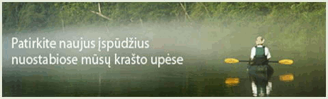
Strėva flowing Trakai and Liepaja district. Nemunas ds. tributary. Length of 80 km, the catchment area of 747 km ². Starts at Mackantiškių, 5 km to the. from Aukštadvaris. Initially flowing into the district. a Samukas, clothing, Spindžius lakes below to north. a Gilūšis, spruce, Strėva Strėvaičio, Nestrevančio lakes. Elektrėnų passing the lagoon flows into the wind. Flows into the Kaunas Lagoon 5 km to north. from Kruonis. Vaga curvy up Elektrėnų lagoon from 1.5 to 12 m wide, lower - 15-20 m. Depth of 0.5-1.5 m. Lowlands below Buble is the rifts, they 0.4-0.6 m depth. Avg. slope of 137 cm / km. Banks of the lower reaches up to Strėva village, from 0.4 to 2.0 m below to Buble, 2-4, and close to the mouth instead of 40 m in height. Dominating the valley width of 200-400 m at the widest Žiežmarių Valley (1.5 km). Avg. current speed of 0.1-0.3 m / s in the lower reaches 0.7-1.0 m / s. Flow rate to Semeliskiu (upper) max. 6.35 m³ / s, min. 0.58 m³ / s to Strėvininkai (lower) max. 50.4 m³ / s avg. 4.65 m³ / s, min. 0.40 m³ / s. Lakes occupy about 3% Strėva basin area, 12% of wetlands, forests 9%.
Better at higher water levels.
Shoals, rapids, rubble dam.
WW 0/1 (5)
Semeliškės
35.0 dš.protaka length of the lake. Tiltukas. dš.Kudonys. The trip is best to start here, or just below, the Liutoniu. Above the bed of watercourses, there are some places nepraplaukiamų; Elektrėnų from the lagoon to the river quite a long persinešimas. The river flows through the fields, the banks are overgrown with trees, width of 7-10 m, the number of revelers. Avg. slope to the wooden Strėvininkai 115 cm / km.
33.1 tiltukas.
32.7 tiltukas.
31.2 tiltukas. kr.Liutonys.
30.7 tiltukas.
29.9 Bridge. Luton.
29.7 kr.Kiementa.
28.6 Pastrevio pond start. dš.Dirgalonys.
26.8 dš.Obelė. Bridge. Pastrevio HE Dam. Height (pressure) is 10 m pond area of 18 ha. dš.užtvanka (clog comfortable ds.) kr.vandens bandwidth, adjustable barrier for the concrete channel (length 160 m). It falls on the river 10 m. Sometimes floods are part of the channel allowed Strėva water - formed a complex threshold (about 5 WW). At certain water levels at the end of the threshold results in a very dangerous "boiler". Channel beginning tiltukas. kr.Mūro Strėvininkai mound.
26.6 tiltukas. dš.Bačkonys. River width of 7-11 m. Revel. Current is stronger. Below are a few kilometers of river banks.
26.5 tiltukas.
25.6 kr.S-third kr.Oginskių palace.
25.3 kr.Kalpė. kr.Mūro Strėvininkai. Km below starts channeled river stretch. Riparian vegetation free.
22.7 kr.Martiniškis.
21.2 dš.S-fourth
21.1 kr.Kertus.
20.7 Bridge. After the bridge shoal. Žiežmariai.
20.3 dš.Kunigo creek. Tiltukas.
18.9 kr.Kristupis.
18.6 tiltukas.
18.7 Žiežmarių-Kruonis road bridge.
18.4 dš.Žiežmarė.
17.4 kr.S-first kr.Mediniai Strėvininkai.
16.1 Bridge. Avg. slope to Tadaravos 133 cm / km.
Dš.S 15.3-second
14.7 Bridge. dš.Stoniava. Channeled river stretch ends. Coasts appears woods. Revel in the river turns, width of 8-12 m.
13.4 dš.Lijonas.
11.1 kr.Limšius.
10.1 Kaišiadorių-Kruonis road bridge. Buble.
9.6 dš.Bijautonių mound.
8.4 Buble pond start.
7.6 dš.Bijautonys.
7.2 Buble HE atvadinis channel.
6.9 Buble HE Dam. Height of 7 m, a pond area of 22 ha. Rare river shoals, current, width of 10-15 m.
6.3 transitions.
5.2 Bridge. dš.Leliušiai.
4.6 kr.Seibutai.
3.7 Rumšiškių-Kruonis road bridge. kr.Tadarava. Avg. slope to Surgantiškių 133 cm / km.
3.5 transitions.
2.7 Begins Kaunas Lagoon head.
1.9 kr.Surgantiškės. kr.Maisiejūnų mounds.
0.9 dš.Lašinių mound. dš.Lašiniai. Bacon stone. Bacon conglomerate escarpment.
0.0 Strėva flows into the Neman. (KPSP channel). Bridge beneath užtvankėlė. kr.Kruonio PSP.